
Last Mile
Kailash Manasarovar: Trek From India
Mount Meru: Centre of the World
 By Spiritual Yatra
40 min read
By Spiritual Yatra
40 min read

KAILASH-MANASAROVAR: THE GREAT TREK FROM INDIA, MOUNT MERU: THE SPIRITUAL CENTRE OF THE UNIVERSE

At a Glance: The Sacred Geography and Journey
-
Location: Situated on the magnificent, windswept, and treeless expanse of the Barkha Plain in the remote Ngari District of Western Tibet, China. The region sits at an unforgiving average altitude of 15,000 to 16,000 feet above sea level.
-
Distances:
-
-
- The Indian Side: The journey covers 629 kilometers from New Delhi to the roadhead of Dharchula in the state of Uttarakhand. From Dharchula, it is a demanding 65-kilometer journey, undertaken either on foot or by pony, traversing the rugged Indian Himalayas.
- The Tibetan Side: After crossing the border, it is a 162-kilometer bus journey from the Lipu Lekh Pass to Darchen via the town of Taklakot.
- The Circumambulations (Parikramas): The Kailash Parikrama covers 53 kilometers (completed partly by bus to the starting point, but largely by an arduous trek). The Manasarovar Parikrama covers approximately 95 kilometers, which is now predominantly completed by bus, though devoted pilgrims can choose to complete it on foot.
-
-
Total Duration: 26 transformative days.
-
The Complete Route from Delhi:
-
-
- Drive via National Highway 24 to Rampur (passing through Hapur and Moradabad).
- Take National Highway 87 to the railhead towns of Haldwani and Kathgodam.
- Navigate state mountain highways to the roadhead at Mangti, passing through scenic Kumaoni towns including Bhimtal, Bhowali, Garampani, Almora, Dharchula, and Tawa Ghat.
- Commence the pony ride or foot trek ascending toward the Lipu Lekh Pass, halting at the high-altitude camps of Gala, Budhi, Gunji, Kalapani, and Navidhang.
- Cross into Tibet and proceed by road to the sacred realms of Mount Kailash and Lake Manasarovar.
-

Part I: The Call of the Divine Mountain
It is freezing cold as you stand on the desolate, windswept plateau, your breath pluming in the thin air, as you gaze upon a summit that appears to be on fire with the first rays of the morning sun. It is a moment where time stands still, and you marvel as the deepest desire of your heart finally manifests into reality. Before you shimmer Lake Manasarovar and Mount Kailash—the holiest body of water and the most sacred mountain on the face of the earth. Together, they form a living, breathing shrine, the ultimate destination of one of the greatest, hardest, and most spiritually rewarding earthly pilgrimages known to humanity.
Long before the lines of modern nation-states were carved into maps, the most devoted, resolute, and fearless pilgrims aspired to complete this unparalleled journey, seeking the ultimate path to moksha (spiritual liberation). Centuries ago, embarking on this yatra meant accepting that it might very well be a one-way journey. If the grueling, lung-busting mountain trek, the avalanches, or the bone-chilling cold didn't claim your life, the predatory robber gangs roaming the lawless Tibetan plains might. In ancient India, if a pilgrim did not return to their village after a period of two years, their family and community presumed they had cast off their mortal coil and ascended directly to Vaikunth—the supreme cosmic realm—having successfully fulfilled their holy duty.
Today, the logistics of the journey have been modernized, but the spiritual gravity and physical demands remain monumental. The Ministry of External Affairs (MEA), Government of India, officially organizes the Kailash-Manasarovar Yatra along this ancient, traditional route. Conducted annually between the monsoon months of June and September, it is a meticulously planned 26-day round-trip starting from the national capital, New Delhi.
Accomplished with exceptional logistical support, military-grade security, and reasonable comfort, the MEA route is widely considered the most reliable, economical, safe, and culturally immersive way for an Indian citizen to undertake this yatra. Instead of being left to the mercy of unpredictable, profit-driven private tour operators who often rush pilgrims to dangerous altitudes, the MEA yatra treats every pilgrim as a guest of the Government of India. The yatra is heavily subsidized, making it far more economical than the packages sold by operators in Nepal. Most importantly, there is absolute transparency regarding what is offered, what is required, and what is provided.
Because the journey is so demanding, selection is not merely a matter of paying a fee; it is based on a rigorous, two-level medical and physical evaluation.
The Strategy of Gradual Acclimatization The single greatest advantage of the Indian route is its geographical profile, which ensures slow, gradual acclimatization to the extreme altitudes—a critical factor in surviving and enjoying the Tibetan plateau. Unlike the Nepal route, where pilgrims are driven rapidly up to 15,000 feet, the Indian route requires pilgrims to physically trek over the Indian Himalayas day by day, steadily climbing toward the Lipu Lekh Pass on the Indo-Tibet border. Because the body is given days to adapt to the thinning air, even healthy 60-year-olds in well-prepared groups routinely accomplish this climb.
The yatra through India is not just a transit; it is a pilgrimage in itself. It offers incredible, awe-inspiring mountain vistas and passes through deeply sacred regional sites. Pilgrims witness the magnificent Om Parvat, the serene lakes of Bhimtal, the ancient temple complexes of Almora and Jageshwar, and the mystical subterranean caves of Pataal Bhuvaneshwar. All the while, the towering, holy peak of Nanda Devi watches over the yatris, blessing them all the way to Dharchula. Returning through this region—revered in ancient texts as Deo Bhumi (The Land of the Gods)—feels like walking through the corridors of heaven.
The Infrastructure of Care Under the dedicated aegis of the Kumaon Mandal Vikas Nigam (KMVN)—the state tourism agency—decent, hot food and pucca (solidly built) accommodation are provided at every stop on the Indian side, complete with proper restroom facilities. While facilities—especially toilets—become remarkably primitive once you cross onto the Chinese side, yatris on the MEA route are not required to sleep in flimsy tents anywhere along the way, a massive advantage against the biting Tibetan winds.
The Indo-Tibetan Border Police (ITBP) serves as the backbone of this expedition. They provide security, medical support, and logistical assistance in some of the most unforgiving terrain on earth. By the end of the yatra, every pilgrim comes away with a profound sense of awe and gratitude for the ITBP jawans.
To ensure seamless coordination, a Liaison Officer (LO) is appointed by the government for each batch of pilgrims. This individual is always a senior, gazetted official of the Indian government (from the IAS, IPS, or Allied Services) and is typically an experienced high-altitude trekker. Furthermore, each batch usually contains at least two medical doctors (traveling as yatris themselves), equipped with a comprehensive medical kit. The LO carries a satellite phone, ensuring that contact with the outside world is maintained throughout the journey, enabling rapid response during emergencies. Based on the LO's daily status reports, the KMVN website is updated so anxious families back home can track the progress of their loved ones. At almost all camps on the Indian side, STD or ISD phone facilities are available.
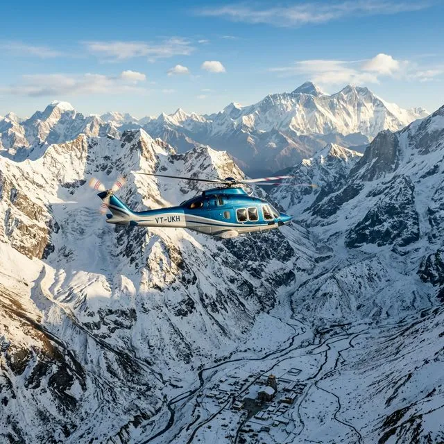
If a medical emergency strikes on the Indian side of the border, the government immediately deploys helicopter evacuation services. This is not a theoretical safety net; helicopters are routinely dispatched to rescue yatris who display severe symptoms of Acute Mountain Sickness (AMS). Once on the Tibetan side, the presence of the LO—who travels on an official "white" government passport—makes navigating the often rigid and difficult Chinese immigration and military bureaucracy infinitely smoother.
Because the MEA manages this yatra with such precision, there is a powerful continuity across the different batches that travel sequentially throughout the summer. If a pilgrim from an incoming batch is injured or falls ill, they are often safely escorted back down the mountain by the returning batch. The safety record of this route is exemplary; out of hundreds who travel, only a tiny fraction ever fail to complete the journey due to health reasons.
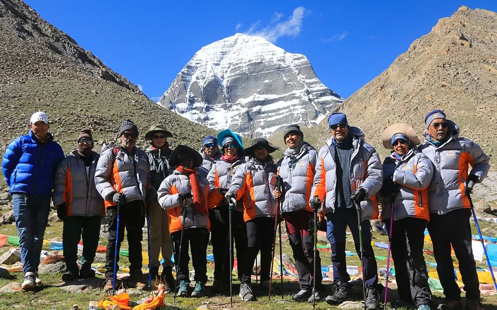
With every logistical detail handled by the state, the yatri is liberated from the anxieties of travel. You are free to focus your entire being on the most important spiritual journey of your life, traveling in the company of fellow citizens from every corner of India. While the more athletic members of a group may trek every single mile, others take a pony for the entire duration. The groups are diverse, with the male-female ratio usually hovering around 60:40. You will find yatris in their mid-20s walking alongside devoted pilgrims in their early 60s. Even if you are middle-aged and have only ever seen mountains in calendar photographs, you are a viable candidate for this yatra. It is not fundamentally a test of brute physical strength, though a sound constitution is necessary. What is truly required is heartfelt devotion, unwavering mental resolve, and a burning, singular desire to complete the parikramas.
If this applies to you, you must go.
When you return, you will be a fundamentally altered human being. Your friends and family will expect grand pujas and celebratory feasts. You will occasionally encounter the naive acquaintance who casually asks, "So, how was Amarnath?" entirely unaware of the scale of what you have just achieved. Physically, you will likely return five to ten kilos lighter, and the immense cardiovascular strain you endured will have conditioned your heart and lungs, potentially extending your life expectancy. But the physical changes pale in comparison to the spiritual elevation. It is not just the destination that matters; every step of the 26-day yatra weaves itself into the fabric of your soul. Things change for the better on their own when you return—spiritually uplifted, mentally invincible, and physically renewed.
Part II: Legends, Mythology, and the Tapestry of History
The reverence for Mount Kailash predates almost all other religious pilgrimages in the Indian subcontinent. While Lord Shiva is famously known to visit the holy city of Varanasi, his eternal, permanent abode is always Mount Kailash, where he dwells in perpetual meditation with his divine consort, Goddess Parvati.
The Axis of the Cosmos For Hindus, Mount Kailash is the earthly, physical manifestation of the revered Mount Meru—the energetic and structural center of the universe. In the epic Bhagavad Gita, Lord Krishna declares his supreme nature by stating, "Among the mountains, I am Meru." It is considered the merudanda, the cosmic spinal cord, the axis mundi that connects the heavens, the earth, and the underworld, holding the very fabric of reality together.
The Vishnu Purana, an ancient text dating back to approximately 200 BCE, provides a staggering cosmological description of the world. It states that the earth is made up of seven concentric continents ringed by seven oceans. "The central continent has Meru at its core, bounded by three mountain ranges to the north and three to the south. One of these ranges is the Himalayan barrier, interposed between Meru and 'Bharatha', the Indian subcontinent. Meru itself stands eighty-four thousand leagues high, with four faces of crystal, ruby, gold, and lapis lazuli. The divine river Ganga falls from the heavens directly onto Meru's summit, circles the mountain, and then divides into four mighty rivers which flow to the four quarters of the earth."
Modern geography mirrors this ancient cosmic map with astonishing accuracy. The Kailash-Manasarovar region is the actual hydrographic nexus of Asia, serving as the source of four of the continent's greatest rivers: the Brahmaputra (flowing east), the Indus (flowing north), the Sutlej (flowing west), and the Karnali (flowing south to join the Ganges).
The Twin Lakes of Light and Shadow According to the Puranas, Lake Manasarovar was conceived in the mind of Lord Brahma, the creator of the universe (hence the name Manas meaning mind, and Sarovar meaning lake). Legend states that twelve pre-Vedic rishis (sages), the sons of Brahma, performed intense austerities in the freezing wilderness near Kailash for twelve years. Eventually, they were blessed with the divine darshan (vision) of Shiva and Parvati. Overjoyed but exhausted, the rishis supplicated Brahma for a body of water where they could perform their holy ablutions. In response, Brahma manifested the massive, emerald-blue expanse of Manasarovar. To this day, devout pilgrims firmly believe that in the dead of the freezing night, during the Brahma Muhurta (the ambrosial hours before dawn), celestial beings and gods descend from the heavens to bathe in Manasarovar. It is written that a single dip in these glacial waters washes away the accumulated sins of a hundred lifetimes, allowing the pilgrim to be born again, free of all karmic debt.
Right beside the lake of light lies its dark twin, Rakshas Tal (The Lake of Demons). While Manasarovar is shaped like the sun and represents pure consciousness, Rakshas Tal is shaped like a crescent moon and represents darkness and chaotic power. Hindu mythology associates Rakshas Tal with Ravana, the brilliant but arrogant demon-king of Lanka. It is said that Ravana performed extreme penance on the shores of this lake to win Lord Shiva's favor, intending to literally uproot Mount Kailash and carry it back to Lanka. Perturbed by this terrifying prospect, the gods pleaded with Lord Ganesh for divine intervention. Using his supreme intellect, Ganesh tricked Ravana into holding the mountain while Ravana relieved himself—a task that took magically long, permanently rooting the mountain back to the earth and giving birth to the dark waters of Rakshas Tal.
Historically, it is believed that Manasarovar and Rakshas Tal were once a single, massive body of water with an island in the middle. Today, they are separated by a narrow isthmus of low hills, connected only by a thin, mostly dry channel known as the Ganga Chu. Hindus and Buddhists consider Rakshas Tal inauspicious. While there are several active monasteries ringing the 88-kilometer circumference of Manasarovar, there is not a single monastery along the 115-kilometer perimeter of Rakshas Tal. Paradoxically, the dark lake receives the direct glacial meltwaters flowing down from Kailash, while the holy Manasarovar is fed by the streams of the Gurla Mandhata mountain.
The Mountain of Four Faces Standing isolated and majestic at 22,027 feet, Mount Kailash is not the highest peak in the region, but its striking, symmetrical, four-faced pyramid shape makes it utterly unique. Deep clefts on either side sever it from the rest of the Kailash Range, making it one of the only major mountains on earth where a complete pedestrian circumambulation (parikrama or kora) is geographically possible. An aerial photograph of the peak bears a breathtaking, uncanny resemblance to the Shivaling worshipped in Hindu temples. Devotees believe that completing one parikrama of the mountain frees a soul from the endless cycle of birth, death, and rebirth. Those who manage to complete 21 parikramas of the traditional outer route earn the right to undertake the highly dangerous "Inner Parikrama," a treacherous route that climbs high across the four vertical faces of the mountain itself.
High on the parikrama route, just past the grueling Dolma La pass, lies Gauri Kund (18,536 ft), the highest freshwater lake in the world. This small, jade-green pool is where Goddess Parvati came to bathe when the gods sought her protection. Frozen solid for more than half the year, the waters of Gauri Kund are credited with immense healing properties, particularly regarding fertility.
A Convergence of Faiths While Hindus see Kailash as Shiva's throne, three other major religions claim the mountain as their holiest site.
- Jainism: Jains know the mountain as Ashtapada (The Eight-Stepped Mountain). It is the sacred site where Rishabhanatha, the very first Jain Tirthankara, achieved moksha (enlightenment and liberation).
- Buddhism: Tibetan Buddhists call the mountain Kang Rinpoche (The Precious Jewel of Snow). They believe it is the earthly dwelling of the legendary deity Lord Demchog, who resides there in supreme bliss with his scarlet consort, Dorje Phangmo. In 1093, the great Buddhist yogi and poet Milarepa arrived at Kailash, engaging in a legendary magical battle with a Bon sorcerer to secure the mountain for Buddhism. Milarepa is also credited with popularizing the supreme Tibetan mantra, 'Om Mani Padme Hum' in the region.
- The Bon Faith: The ancient, pre-Buddhist, shamanistic religion of Tibet, known as Bon-Po, holds the mountain sacred as the "Nine-Storey Swastika Mountain." They believe their deities physically moved the mountain from north-east Tibet to its current location. Uniquely, Bon followers perform the circumambulation counter-clockwise, while Hindus, Buddhists, and Jains walk clockwise.
The Explorers and the Cartographers Indians have been making this treacherous pilgrimage since time immemorial, with Kailash and Manasarovar mentioned extensively in the Skanda Purana, Vishnu Purana, Ramayana, and Mahabharata. However, for the western world, the region remained a blank spot on the map until the 19th century.
As historian Charles Allen writes in A Mountain in Tibet, one of the greatest mysteries for early European cartographers was "the ancient and powerful belief in Asia that somewhere between India and China, there stood a sacred mountain, an Asian Olympus of cosmic proportions. This mountain was said to be the navel of the earth... For more than 2,000 years, it has been the lodestone that draws towards itself all the devotional cults that seek the attainment of bliss through self-sacrifice, austerity, and penance."
The earliest European record of the mountain dates back to 1715, written by an Italian Jesuit missionary named Ippolito Desideri, who caught sight of the peak while traveling to Lhasa. In 1782, John Rennell, known as the 'Father of Indian Geography', mapped the region based purely on Hindu belief, theorizing that the Ganges River flowed from Manasarovar, tunneled completely under the Himalayas, and emerged in India. This geographical inaccuracy was only corrected in 1812 when British explorers Hyder Jung Hearsey and Dr. William Moorcroft disguised themselves, crossed the perilous Niti Pass, and physically surveyed the Manasarovar basin.
Later, in 1862, the British Survey of India needed to map Tibet but was barred from entering. They brilliantly employed the services of the "Bhotia Pundits"—local tradesmen from the Johar Valley's Milam Village. Trained to measure distances by counting their exact paces using Buddhist rosary beads, spies like Nain Singh Rawat (code-named 'Chief Pundit') mapped vast tracts of the Tibetan plateau in secret.
In 1907, the legendary Swedish explorer Sven Hedin finally mapped the region comprehensively, describing Kailash as "a bare rocky countryside out of which the summit of a snow-clad mountain rose up like a glittering pyramid of silver." Hedin was also the first to measure the depth of Manasarovar, dropping a sounding line to 269 feet. Decades later, in 1945, the famed Indian ornithologist Salim Ali crossed the Lipu Lekh Pass on a bird-watching pilgrimage, marveling at the "superb views from various places along the route of Nanda Devi, Nanda Kot, and the Panch Chuli peaks."
Geologically, Kailash is an anomaly. The mountains of the Tibetan plateau are primarily composed of tertiary conglomerates—massive quantities of rounded, water-worn stones and shingle cemented together over millions of years by clay and tectonic pressure. The land from Taklakot to Manasarovar is a flat, stony, high-altitude desert. Standing alone in this desert, Kailash is essentially the world's largest single deposit of tertiary conglomerate rock, pushed to the heavens by the collision of the Indian and Eurasian tectonic plates.
Part III: The Crucible of Preparation
If you are the type of traveler looking for a 'Quick Kailash' helicopter tour to snap a few photos and rush back to civilization, this route—and this guide—is not for you. The MEA Yatra is not for someone who is "too busy" for Shiva. The modern world offers fast-track packages where you can fly from Delhi to Kathmandu, hop a plane to Lhasa, drive to the mountain, and declare the pilgrimage done.
The Indian land route is an entirely different beast.
On this yatra, you will encounter a staggering cross-section of humanity. You will meet polite mandarins from the Ministry of External Affairs, warm and tireless hosts from KMVN, stoic and heroic ITBP jawans, and rosy-cheeked children from isolated Himalayan villages who greet you with the mantra that becomes the heartbeat of the journey: 'Om Namah Shivaya'. You will face grim, unsmiling Chinese immigration officials and helpful Tibetan guides trying out broken Hindi.
Above all, you become an inseparable part of a traveling family for nearly a month. In a typical group of 25 to 30 yatris, you will hear a cacophony of languages: Tamil, Telugu, Kannada, Malayalam, Bengali, Gujarati, Marathi, Punjabi, Bhojpuri, and Marwari, all seamlessly blending with Hindi.
If you begin this journey with an inflated ego, Kailashpati Mahadev will systematically dismantle it long before you reach his abode. High altitudes are the ultimate equalizer; they humble billionaires and athletes alike. You must prepare to leave modern luxuries behind. For weeks, you will not see a flush toilet. You will sleep in basic dormitories, walk until your muscles scream, and face winds that feel like ice slicing through your clothes. It is a punishing journey that will dredge the very bottom of your inner reserves. Yet, the spiritual magnetism of the mountain is so profound that virtually no pilgrim complains. You will see people enduring extreme physical distress with serene smiles on their faces.
The Application and the Lottery The journey begins months before you pack your bags. Between mid-January and early February, the Ministry of External Affairs publishes advertisements in all major national newspapers inviting applications. You must hold an Indian passport valid for at least six months beyond the yatra dates. Because demand far exceeds capacity, a computerized draw of lots decides who goes. Thousands apply, but only a few hundred are chosen across the 16 batches. It is a deeply held belief among pilgrims that human will is irrelevant; you only go if Shiva himself signs your invitation.
The Medical Gauntlet Four days before the yatra officially begins, the selected pilgrims gather in New Delhi. The atmosphere is tense, as selection by lottery does not guarantee your spot—you must pass the medical gauntlet. At the renowned Batra Hospital, pilgrims undergo an exhaustive battery of diagnostic tests: Treadmill Tests (TMT) to check cardiac stress response, Electrocardiograms (ECG), comprehensive blood panels, blood sugar fasting, and chest X-rays.
The next day, medical officers from the ITBP Base Hospital review the reports. Blood pressure is meticulously checked. Those who fail to meet the strict high-altitude parameters are gently but firmly sent home—a heartbreaking but necessary reality to prevent fatalities at 18,000 feet. In a typical year, out of roughly 600 applicants who arrive in Delhi, about 50 to 70 are disqualified on medical grounds. When the final list is announced, a wave of palpable relief sweeps through the group.
Physical Conditioning While the medical test checks your heart, the mountains will test your legs and lungs. Preparation must begin months in advance. If you live or work in a multi-story building, abandon the elevator immediately. Walk up and down the stairs for hours. Engage in brisk, aerobic walking. If you use a treadmill, set it to a severe incline (4 to 5 km per hour). More importantly, do this training wearing the exact grip-soled, ankle-length trekking boots you plan to wear on the yatra. Breaking in your boots is non-negotiable; a severe blister on day three can end your pilgrimage.
You do not need to carry a heavy 20-kilo rucksack during training—your hired pony or porter will carry your main luggage. However, your cardiovascular endurance must be exceptional. And yet, physical strength is only half the battle. Mental fortitude and absolute faith are the true engines that will drive you over the Lipu Lekh and Dolma La passes.
The Send-Off The government ensures the pilgrims depart with the blessings and respect of the nation. The Delhi Government hosts a grand send-off ceremony, often attended by the Chief Minister, where yatris are gifted high-quality waterproof rucksacks and raincoats. NGOs distribute comprehensive medical kits, high-energy provisions, and supplementary warm clothing. The yatris are treated like VIPs, embarking on a national mission of faith.
Part IV: The Ascending Path (Days 1 to 8)
Day 1: Delhi to Bhimtal The journey begins in the sweltering heat of the northern plains. The group boards an air-conditioned bus (or train) for the 240-kilometer, eight-hour journey northeast to Kathgodam, the gateway to the Kumaon Himalayas. Here, the plains end, and the terrain abruptly rises. The group transfers to a fleet of smaller, more nimble hill buses designed to navigate the dizzying hairpin bends of the mountains.
Already, the magic of the yatra begins to work on the group dynamics. Strangers become brothers and sisters. Natural leaders emerge to handle luggage logistics; caregivers step up to look after the elderly; singers lead the bus in resonant, echoing bhajans (devotional songs). Nobody isolates themselves with headphones. After a steep, winding ascent, the group arrives at the pristine lake town of Bhimtal (4,500 ft). The KMVN Tourist Rest House here is excellent, providing the first taste of the crisp mountain air. After dinner, the Liaison Officer gathers the group to teach basic muscle stretching and breathing exercises for the grueling trail ahead.
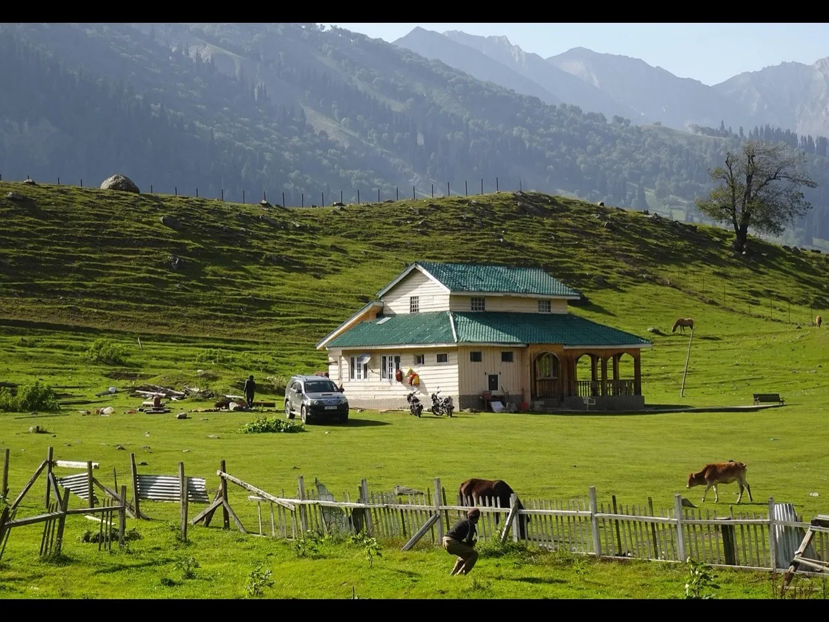
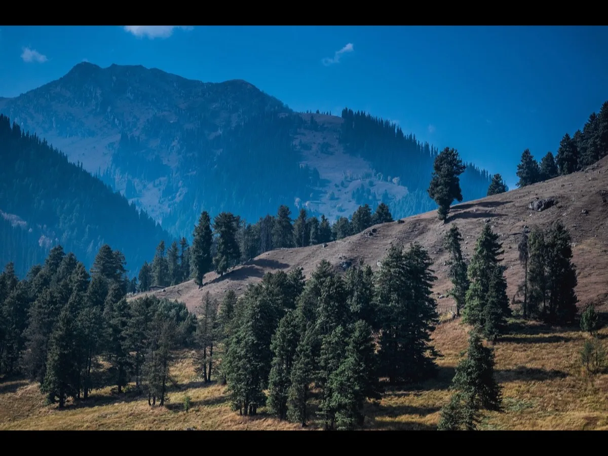
Day 2: Bhimtal to Dharchula This is a long, visually spectacular drive pushing deep into the verdant heart of the Himalayas. The buses wind through dense pine forests and terraced agricultural slopes. A highly anticipated lunch halt occurs at the KMVN Rest House in Chaukori, a hamlet perched on a high spur surrounded by lush tea estates.
From Chaukori, the sky opens up, offering a glorious, uninterrupted panorama of the Nanda Devi massif. Towering at 25,646 feet, Nanda Devi is the highest mountain located entirely within India, and it is higher than Mount Kailash itself. In local folklore, the mountain is the physical manifestation of Goddess Parvati, watching over the pilgrims as they march toward her husband’s domain.
The journey continues to the ITBP camp at Mirthi, where the Camp Commandant delivers a solemn, detailed briefing regarding the security and topographical challenges of the border regions ahead. Finally, after 14 hours of travel covering 313 kilometers, the buses roll into Dharchula (2,300 ft). Nestled in a deep valley on the banks of the roaring Kali River, Dharchula is a bustling border town. Across the river lies the country of Nepal. The altitude here is still low, and the night is comfortably warm. Yatris make last-minute purchases in the local markets, buying cheap, heavy woolens and walking sticks.
Day 3: Dharchula to Gala – The Trek Begins The morning is chaotic but highly organized. All luggage is packed in heavy-duty, waterproof canvas bags, rigorously weighed, and handed over to the KMVN luggage contractors. The strict limit is 25 kg per yatri. After a vibrant cultural send-off featuring traditional Kumaoni music and dance, the group drives 43 kilometers to the ultimate roadhead at Mangti (4,325 ft).
This is where the asphalt ends and the true physical pilgrimage begins. At Mangti, a massive, noisy melee of local porters and pony handlers negotiate with the yatris. Once the mounts are assigned and the walking sticks are deployed, the group turns northeast, stepping onto the ancient trail toward Gala (8,005 ft).
The 3-kilometer uphill trek to the first camp takes about three hours. It is a steep, shocking introduction to mountain walking. Those who trained on staircases at home silently bless their preparation, while others realize the terrifying scale of the physical challenge ahead. The pony riders, initially terrified of staring down sheer cliffs from the back of a moving animal, learn to trust their sure-footed mounts. Upon reaching the Gala camp, the air is noticeably thinner and colder. The group's "troubleshooting committees" swing into action, ensuring everyone has their luggage and a hot cup of tea.
Day 4: Gala to Budhi – The 4,444 Steps If Gala was a warm-up, the trek to Budhi (8,900 ft) is a marathon. It is an 18-kilometer, 11-hour ordeal that features some of the most punishing terrain on the Indian side. The day begins with an infamous, brutal descent of exactly 4,444 stone steps cut into the side of a massive gorge. The constant downward pounding is agonizing for the knees and calf muscles.
At the bottom of the gorge, the group stops for lunch at Lakhanpur, right on the violent, foaming banks of the Kali River, which now serves as the permanent border between India and Nepal. The river's deafening roar will be the soundtrack of the yatra for the next six days. The trail then ascends sharply again, passing through landscapes of staggering beauty. As the altitude creeps toward 9,000 feet, the subtropical vegetation vanishes, replaced by alpine forests. Suddenly, through a break in the trees, the first jagged, snow-capped peaks of the high Himalayas appear, gleaming like silver in the afternoon sun. Exhausted but elated, the group arrives at the KMVN huts in Budhi, welcomed by the broad smiles of the staff and the scent of a hot, well-earned dinner.
Day 5: Budhi to Gunji – The Sinking Village The morning presents the single steepest climb on the Indian route: the dreaded Chhialekh ki Chadhai. Rising directly above Budhi, it is a near-vertical 2-kilometer zigzag trail that ascends over 1,500 feet. Even the most hardened, athletic trekkers swallow their pride here and hire a pony. Reaching the high alpine meadow of Chhialekh takes about two hours of heart-pounding effort.
But the reward at the top is spectacular. A massive, heartwarming banner flutters in the wind: "Welcome, Kailash Manasarovar Yatris, from ITBP." The jawans at the command post serve steaming hot tea and fresh pakoras—a feast fit for kings at 10,500 feet.
From Chhialekh, the trail flattens out, winding northeast across sprawling, emerald-green meadows that rival the pastoral beauty of the Swiss Alps, with the colossal Annapurna range looming to the right. The trail skirts Garbyang, known ominously as the 'sinking village.' Built on unstable shale and weakened by tectonic shifts, the ancient houses of Garbyang have been slowly sliding down the mountain into the river gorge for decades. An ITBP patrol joins the group here, providing an armed escort as the trail runs uncomfortably close to Maoist-controlled territories on the Nepalese side of the river.
Finally, the village of Gunji (10,500 ft) appears in the distance. The 20-kilometer trek has taken 10 hours. At Gunji, the ITBP maintains a major base. The jawans welcome the pilgrims with overwhelming hospitality. A critical second round of medical check-ups takes place at the ITBP Advanced Hospital. Blood oxygen levels are monitored closely. The atmosphere is joyous; the jawans organize a makeshift cricket match with the pilgrims, followed by a roaring game of Antakshari (a musical game) between the yatris and the local porters. The night ends with deeply moving bhajans sung in the ITBP temple.
Day 6: Acclimatization at Gunji This is a mandatory rest day. At 10,500 feet, the air pressure is significantly lower, and the body needs 24 hours to generate the extra red blood cells required to carry oxygen to the brain and muscles. The Liaison Officer conducts horse-riding lessons in the meadows. Yatris wash their clothes, repack their bags, and mentally prepare for the high-altitude desert ahead. (Notably, a separate trail branches off from Gunji toward Chhota Kailash or Adi Kailash, a completely different pilgrimage site, but the MEA group remains focused on the main prize).
Day 7: Gunji to Kalapani – The Source of the River Fully rested, the group embarks on what is universally considered the most visually enchanting walk of the journey: the 9-kilometer trek to Kalapani (11,811 ft). The trail is relatively flat, following the narrowing Kali River through dense, mystical forests of silver birch, pine, ancient bhojpatra (whose bark was used as paper in ancient India to write the scriptures), and fragrant juniper bushes.
Just before reaching the Kalapani camp, thermal hot springs bubble out of the rock, offering a miraculous chance for a hot bath in the freezing wilderness. Kalapani is fiercely guarded by the ITBP, as it is a highly sensitive strategic outpost. A magnificent temple marks the geographic source of the Kali River. High above the camp on a sheer cliff face lies the Vyas Gufa (Cave of Vyas), where legend dictates the great sage Ved Vyas meditated and compiled the epic Mahabharata.
Day 8: Kalapani to Navidhang – The Miracle of Om Parvat The 9-kilometer trek to Navidhang pushes the group to 13,080 feet, well above the tree line. The lush forests disappear, replaced by stark, rocky, alpine tundra. But as the group approaches the Navidhang camp, an awe-inspiring geological miracle reveals itself against the clear blue sky: the legendary Om Parvat.
Towering above the valley, this distinct peak possesses natural striations and ridges on its dark rock face that perfectly trap the falling snow to form a massive, flawless, and unmistakable symbol of the sacred Hindu syllable "Om" (ॐ). It is a sight that brings pilgrims to their knees in tears.
The evening at Navidhang is tense. The ITBP commanders constantly monitor the radio for weather updates regarding the impending border crossing. The yatris retire to their beds immediately after dinner, praying fervently to Kailashpati to bless them with clear skies for the hardest day of the Indian leg.
Part V: Crossing the Threshold (Days 9 to 10)
Day 9: The Lipu Lekh Pass and the Leap into Tibet This is the day that separates the strong from the weak. The objective is to cross the notorious Lipu Lekh Pass (17,828 ft), the geographical and political border between India and China. The pass must be crossed before 9:00 AM. After mid-morning, deadly, high-velocity thermal winds whip through the funnel of the pass, capable of literally blowing a person off the mountain, accompanied by sudden, blinding blizzards.
The group is roused at 2:00 AM. In the freezing darkness, yatris layer on every piece of thermal clothing they own: thermals, sweaters, fleece jackets, down parkas, double gloves, and balaclavas. At 3:00 AM, guided by the beams of flashlights and flanked by a heavy ITBP escort, the group begins the grueling 9-kilometer, vertical assault on the pass.
Because the group has spent days acclimatizing, the ascent is steady, though agonizingly slow. The thin air makes every step feel like walking through wet cement. Lungs burn, and hearts hammer against ribcages. The ponies prove their worth here, carrying exhausted pilgrims up the treacherous ice fields.
Finally, at 7:00 AM Indian Standard Time (which is 9:30 AM Chinese Time), the group crests the Lipu Lekh Pass. The view is staggering. Looking back, the jagged peaks of India tear into the sky. Looking forward, the Tibetan plateau opens up—a vast, brown, treeless, lunar landscape. Early British explorer C.A. Sherring noted that the view of the Gurla Mandhata peak from this pass is "truly one of nature's grandest handiworks. There are no trees or verdure to relieve the severity, and the almost total absence of animal life adds to the feeling of intense desolation."
At the summit, a motley crew of Tibetan porters waits shivering in the wind. The Indian porters and pony handlers bid a tearful farewell to the yatris. All luggage is quickly transferred. The ITBP jawans hug the pilgrims, wishing them luck, before turning back to India.
The group descends rapidly on the Chinese side, dropping 200 feet to escape the howling winds, and waits for the Chinese immigration authorities. Passports and group visas are scrutinized by grim-faced soldiers in thick olive-green coats. Once cleared, the group boards a fleet of modern, air-conditioned Chinese buses. The transition is jarring. A smiling Tibetan guide offers a traditional white silk scarf (khatta) and a cold can of Pepsi. After days of grueling foot travel, sinking into a plush bus seat feels surreal.
The bus drives 22 kilometers north through a barren, rocky moonscape to the town of Taklakot (also known as Purang). Despite being at 13,123 feet (higher than Navidhang), Taklakot sits on a flat, dusty plain. The group checks into the Purang Guest House on Main Street, relishing the luxury of a hot shower.
Day 10: Acclimatization and Logistics in Taklakot The group spends a full day in Taklakot while the Tibetan agency finalizes the complex logistics, permits, and food supplies required for the wilderness of the parikramas. Pilgrims exchange US Dollars for Chinese Yuan at local banks or with private money changers.
Taklakot is a bizarre mix of the ancient and the modern. Main Street is lined with snooker parlors, internet cafes, and shops renting the latest Bollywood DVDs. Yet, just a short walk away is the Nepali Mandi, a traditional trading bazaar where one can haggle for cheap Chinese electronics, Tibetan handicrafts, thick blankets, and walking gear. Mobile networks (China Mobile) ping back to life here, and yatris crowd the ISD booths to call home and announce they have successfully entered Tibet.
Part VI: The Lake of the Mind (Days 11 to 14)
Day 11: Taklakot to the Shores of the Divine At 6:00 AM, under a sky ablaze with brilliantly twinkling stars, the buses roll out of Taklakot. The well-paved highway climbs steadily toward the Gurla Pass (16,125 ft). As the bus crests the pass, a collective gasp echoes through the cabin.
To the right, the massive, glaciated bulk of Gurla Mandhata (25,354 ft) feels close enough to touch. But directly ahead, dominating the northern horizon, is a perfectly symmetrical pyramid of pure white snow.
Mount Kailash.
A resounding, ecstatic roar of "Om Namah Shivaya! Har Har Mahadev!" shakes the bus. Tears stream down the faces of men and women who have waited their entire lives for this singular moment. The mountain does not look like rock and ice; it looks like a conscious, living entity radiating a benign, overwhelming power.
The bus descends from the pass and halts on the stony banks of Rakshas Tal (14,815 ft). The yatris disembark, stunned into silence by the sheer magnitude of the landscape. They skirt the dark, brooding waters of the demon lake and cross the narrow isthmus to the shores of Lake Manasarovar (14,862 ft).
The contrast is immediate. Manasarovar is a vision of indescribable beauty. Depending on the angle of the sun and the depth of the water, the lake displays half a dozen distinct colors simultaneously—from pale jade near the sandy shores to a deep, impenetrable sapphire at its center. The bus travels to Qihu (Chiu) Gompa, a monastery perched precariously on a craggy rock overlooking the water. Here, the pilgrims step onto the spongy, marshy shore, letting the icy water wash over their boots.
Day 12: The Holy Dip at Qugu Because infrastructure is limited, the MEA group is split in two. Half will proceed to the Kailash Kora, while the other half remains to complete the Manasarovar Parikrama. (They will swap after three days).
The Manasarovar group travels to the camp at Qugu, situated directly on the southern shore, right at the water's edge. They wake before dawn. Across the vast, shimmering expanse of the lake, Mount Kailash glows ethereal in the morning light. The yatris, now supremely well-acclimatized, prepare for the ritual dip. This must be done early, before the violent afternoon winds whip the lake into ocean-like swells.
Despite the freezing temperature of the glacial water, faith overrides physiology. The pilgrims wade into the crystal-clear water, dunking themselves fully. They emerge shivering uncontrollably, but with eyes shining with an inner, incandescent joy. They carefully fill jerry cans and copper vessels with the holy water—the ultimate prasad (blessed offering) to take back to their families in India.
After dressing in layers of dry wool, the group gathers at a designated stone platform near the Qugu monastery. A Hindu priest among the yatris lights a small havan (sacred fire ritual), chanting Vedic mantras that are instantly swallowed by the vastness of the Tibetan sky. Later that night, the most devoted pilgrims huddle in the freezing dark by the shoreline, hoping to catch a glimpse of celestial beings descending as stars to bathe in the waters.
Day 13-14: The Manasarovar Parikrama and Transit to Darchen The following day is spent marveling at the shifting moods of the lake. Some pilgrims visit the natural hot springs near Chiu Gompa.
On Day 14, the group completes the 95-kilometer circumambulation of the lake. While the bus drives most of the route, many yatris insist on walking a 15-kilometer stretch along the serene, winding shoreline, matching their breathing to the rhythmic lapping of the waves.
Once the lake parikrama is complete, the bus turns north, driving 42 kilometers across the flat, dusty Barkha Plain toward the town of Darchen (15,000 ft). Darchen is the chaotic, bustling base camp for the Kailash Parikrama. It is a frontier town filled with Tibetan nomads, Chinese military personnel, barking mastiffs, and pilgrims from all over the world. The Indian yatris check into their guest houses, noting with pride that they are far better acclimatized than the pale, exhausted tourists who have just flown in from Lhasa or Kathmandu.
Part VII: The Supreme Circumambulation (Days 15 to 18)
Day 15: Darchen to Deraphuk – The North Face This is it. The culmination of the journey. The 53-kilometer Kailash Parikrama begins.
The group takes a short bus ride 5 kilometers west of Darchen to Yama Dwar (The Gateway of the God of Death). Walking through this small stone archway signifies leaving behind the fear of mortality and entering the divine realm. Here, the trail begins in earnest. Yatris who cannot walk the entire distance hire ponies or yaks. (Experienced guides highly recommend ponies over yaks; yaks are notoriously stubborn, incredibly wide, and have a terrifying habit of walking on the extreme outer edge of sheer cliffs).
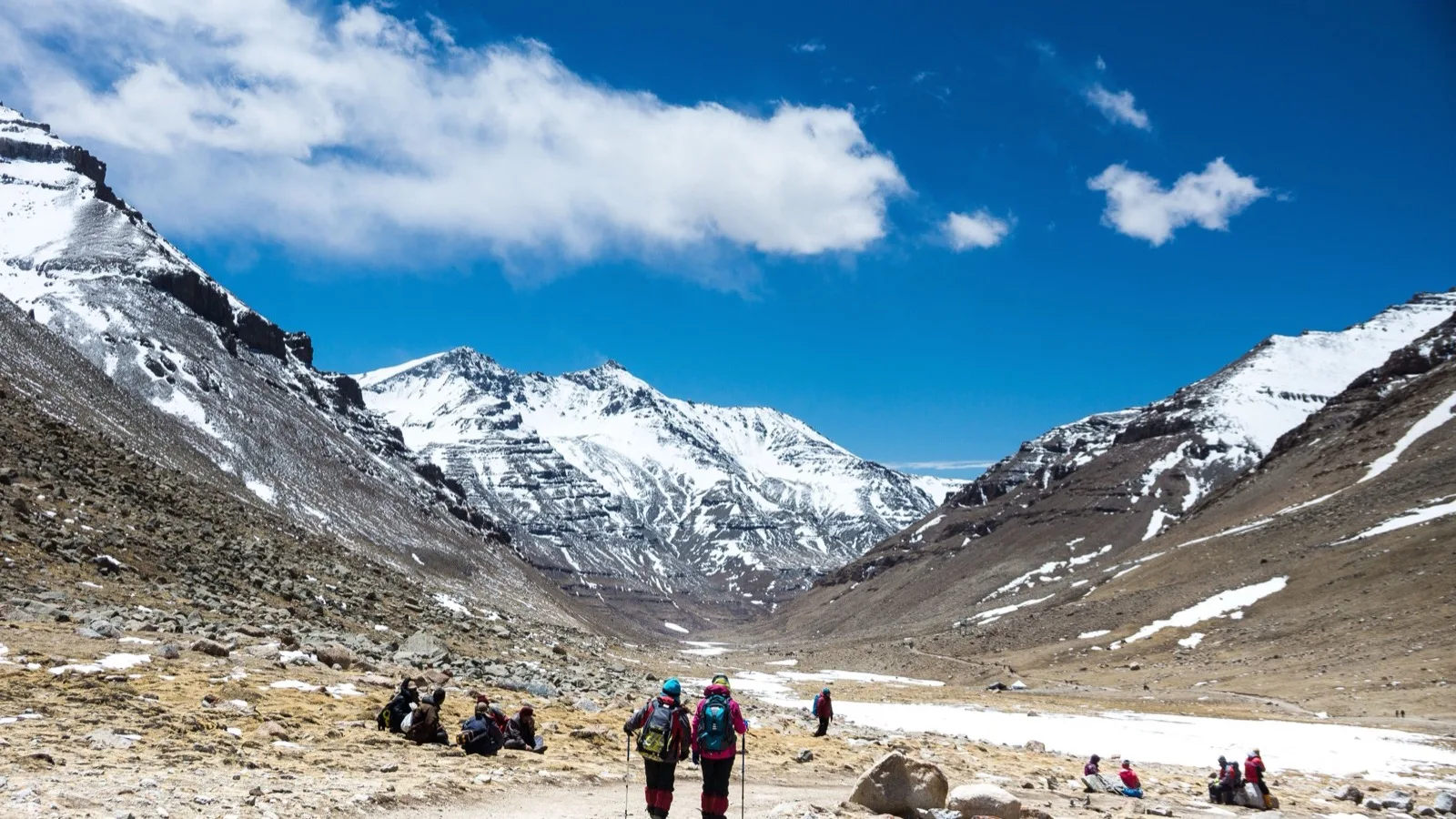
The trail heads north into the Lha Chu valley. The walk to the first camp at Deraphuk (17,000 ft) is 14 kilometers and takes about 5 to 6 hours. The incline is gradual, following a clear, rushing river. Massive canyons of red and black rock tower on either side.
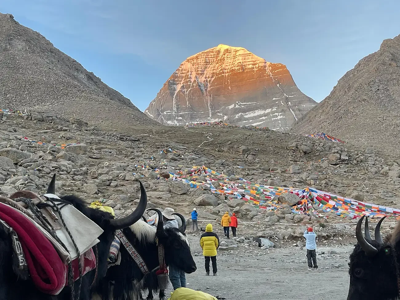
As the valley opens up, the pilgrims are brought to a dead halt. Rising vertically from the valley floor is the sheer, terrifying, and awe-inspiring North Face of Mount Kailash. It is a monolithic wall of black rock and white ice, looking like the terrifying, omnipotent visage of Shiva himself.
The Deraphuk camp sits directly opposite this face. The winds here are horrific, howling down the glacier. The most adventurous (and foolishly brave) yatris attempt to hike up the moraine to touch the very base of the mountain, but it is a treacherous, lung-bursting scramble. Most are content to sit outside their basic rooms, heavily bundled, staring at the North Face until darkness swallows it.
Day 16: Deraphuk to Dolma La to Zutulphuk – The Trial of Faith This is the longest, hardest, and most dangerous day of the entire yatra. The group must cover 25 kilometers in roughly 15 hours, crossing the highest point of the journey.
The pilgrims wake at 4:00 AM. In the pre-dawn darkness, the first rays of the sun strike the apex of the North Face, setting the ice on fire in brilliant hues of gold and crimson. No cameras can capture the true majesty of this moment; it is burned permanently into the inner eye.
The group sets off. The trail immediately begins a brutal, steep ascent. Soon, they reach Shiv Sthal, a rocky expanse covered in discarded clothing, locks of hair, and drops of blood. Tibetans believe this represents the realm of the dead; they leave behind a piece of themselves to symbolize the death of their old ego, hoping for spiritual rebirth.
From here, the climb to the Dolma La Pass (18,602 ft) begins. It is a soul-crushing, vertical ascent over loose scree and massive boulders. At this altitude, oxygen levels are roughly half of what they are at sea level. Every step requires three gasping breaths. Even those who hired ponies are forced to dismount, as the animals cannot carry weight up the steepest sections of the ice fields.
Step by agonizing step, the pilgrims push their bodies beyond known limits. Exhaustion gives way to a trance-like state. Mantras are chanted not with the voice, but with the rhythm of the heart.
And then, a sea of thousands of colorful prayer flags appears against the sky. They have reached Dolma La.
The pass is wide and fiercely cold. Devout Buddhists fall to their knees in the snow, prostrating before a massive boulder believed to represent the goddess Tara Devi. The Hindu yatris weep openly, collapsing in the snow, overwhelmed by a potent mixture of severe oxygen deprivation and absolute spiritual ecstasy. They have summited the holiest pass in the world.
But the danger is not over. The descent from Dolma La is notoriously treacherous. Immediately over the ridge lies Gauri Kund, a frozen, jade-green teardrop of a lake cradled in the ice. Porters are dispatched to carefully chisel away the ice and retrieve a few drops of the holy water for the pilgrims.
The trail down is essentially a controlled slide over sharp, loose rocks. Knees scream in protest. Finally, the group reaches the valley floor, arriving at two small tea tents run by Tibetan nomads. The steaming bowls of instant noodles and yak-butter tea served here feel like a banquet in paradise. Revived, the group trudges the final 10 kilometers along the river to the mud-brick guest houses of Zutulphuk (15,715 ft), arriving just as the sun sets.
Day 17-18: Zutulphuk to Darchen and the Inner Vistas The final leg of the parikrama is a gentle, 4-hour, 12-kilometer walk out of the valley, returning to the Barkha Plain. The psychological burden has vanished. A palpable, electric joy ripples through the group. Someone pulls out a flute, and the crisp morning air is filled with the classical notes of Raga Hamsadhwani.
As Darchen comes into view, the pilgrims realize they have done it. They have completed the circumambulation of the spiritual center of the universe. They tumble into their rooms, exhausted but radiating a profound inner peace.
On Day 18, a rest day in Darchen, some yatris take a short jeep ride and a steep 3-hour hike toward Ashtapada on the southern face of the mountain. From this vantage point, the vertical striations on the rock face—sacred to the Jains as the steps to liberation—look close enough to touch.
Part VIII: The Journey Home (Days 19 to 26)
Day 19-20: Taklakot and the Khojarnath Monastery The caravan of buses leaves Darchen, returning across the dusty plains to Taklakot. The heavy lifting of the yatra is over.
On Day 20, the group takes a day-trip to the ancient Khojarnath Monastery, located just 25 kilometers away. Nestled near the Karnali River, this stunning red-walled gompa houses three massive, ancient silver idols. While local guides ingeniously market them to Hindu tourists as Lord Rama, Sita, and Lakshman (for a viewing fee of 30 yuan), historical texts confirm they are actually magnificent statues of Buddhist Bodhisattvas.
Day 21: The Return to India Leaving Taklakot, the buses climb back toward the Lipu Lekh Pass. The ascent from the Chinese side is much shorter and easier. At the summit, an emotional scene unfolds. The returning batch of yatris comes face to face with the next incoming batch of MEA pilgrims. The new arrivals look nervous, pale, and anxious. The returning veterans, deeply tanned, lean, and radiating absolute confidence, roar "Om Namah Shivay!" and "Bharat Mata ki Jai!" to encourage them.
The Indian porters and the beloved ITBP jawans are waiting. The yatris cross back into Indian territory, practically flying down the mountain to the Navidhang camp for a celebratory lunch, before descending to Kalapani for the night.
Day 22-24: Descending the Himalayas The walk back is a blur of breathtaking scenery and deep nostalgia. The pressure is off, and the group ambles down the trails, singing bhajans, stopping to photograph the waterfalls, and savoring the thick, oxygen-rich air of the lower pine forests. They retrace their steps through Gunji and Budhi, eventually conquering the 4,444 steps in reverse.
By Day 24, they arrive back at the roadhead in Mangti and board the buses for Dharchula. The small border town, which looked so remote three weeks ago, now feels like a sprawling, chaotic, modern metropolis.
Day 25: The Subterranean Gods of Pataal Bhuvaneshwar As the buses wind back toward Delhi, the KMVN arranges two spectacular detours. The first is to Pataal Bhuvaneshwar (4,430 ft). This is not just a cave; it is a massive, labyrinthine underground limestone cavern system. Pilgrims descend through a narrow tunnel into a subterranean world filled with towering stalactites and stalagmites that perfectly resemble the matted hair of Shiva, the ribs of the mythical serpent Sheshnag, and the severed head of Ganesha. It is a mystical capstone to the journey.
Later, the group drives through fragrant pine forests to Jageshwar (6,135 ft), a heavily forested valley that houses a spectacular cluster of 124 ancient Hindu temples carved from solid stone, dating back to the 9th century.
Day 26: Delhi and the Rest of Your Life The AC buses speed down the highways, leaving the mountains behind. The yatris sleep deeply, exhausted but fulfilled. As the chaotic, noisy traffic of New Delhi surrounds the bus, the stark contrast between the holy mountain and the modern world sets in.
The journey is over, but the pilgrimage has just begun. The blisters will heal, the fatigue will fade, and the financial cost will be forgotten. What remains is an indestructible, diamond-hard core of spiritual peace. Every single pilgrim steps off that bus knowing they have accomplished the impossible, touched the divine, and returned to tell the tale. They are no longer just citizens; they are Kailash Yatris. And when they finally part ways, the only question on their lips is:
"When can we go back?"
Part IX: Comprehensive Fact File and Logistics
The Application and Visa Process
- Keep an eye on major national newspapers between January and February for the MEA advertisement, or check
meaindia.nic.in. - You must have a valid Indian passport.
- If selected via the computerized draw, you will be summoned to Delhi for medical tests.
- The Chinese Group Visa and all Tibet Travel Permits are handled entirely by the MEA and its liaison agencies. You do not need to apply to the Chinese embassy yourself.
The Financial Breakdown While private tours from Nepal can cost upwards of Rs. 1.5 Lakhs for a rushed, dangerous itinerary, the MEA route is heavily subsidized and transparent.
- Payment to KMVN: Approx. Rs. 15,500 (Covers all Indian-side transport, boarding, and lodging).
- Payment for Chinese Side: Approx. US $700 / Rs. 30,000 (Covers Chinese buses, guides, and Tibetan guest houses).
- Medical Tests at Batra Hospital: Approx. Rs. 2,000.
- Ponies/Porters (Indian Side): Approx. Rs. 7,000 for the full two-way trek (Optional but highly recommended).
- Ponies/Yaks for Kailash Parikrama: Approx. 750 Yuan / Rs. 4,500 (Optional).
- Group Pool Fund: Approx. Rs. 2,000 (Collected by the group for common tips, extra food, and emergency cash).
- Total Estimated Baseline Cost: Rs. 61,000 (Minus the value of complimentary gear given by the government, bringing the effective cost down further).
- Note on Subsidies: Many state governments reward pilgrims. For example, the Gujarat government provides a Rs. 20,000 subsidy upon return, and the Delhi government offers Rs. 10,000 upfront.
Understanding the Weather and Wardrobe The Tibetan plateau is a land of meteorological extremes. In July and August, a sunny day on the Barkha plain can push temperatures to a sweltering 20°C, making you sweat in a t-shirt. However, the moment a cloud covers the sun, the temperature plummets, and a freezing wind howls across the plains. Nighttime temperatures routinely drop below zero.
- The Golden Rule: Layering. You must be able to add or remove clothing rapidly.
- The Danger of Wind: Most body heat is lost from the head and hands. A high-quality woolen balaclava, windproof jacket, and thermal gloves are more important than heavy sweaters.
- The Dust: The plateau winds kick up severe alkaline dust. Carry surgical masks or thick cotton bandanas to protect your lungs and throat.
Food, Toilets, and Comfort
- India Side: KMVN provides excellent, hot, vegetarian Indian meals. The tourist huts are basic dormitories, but they are clean, warm, and have proper Indian and Western toilets with running water.
- Tibet Side: Meals are managed by the Nepali/Tibetan contractors. Expect basic survival food: noodles, rice, potatoes, and watery lentils.
- The Bathroom Situation in Tibet: Be prepared for a shock. "Toilets" in Tibetan guest houses are often just foul-smelling outhouses with holes cut into a raised dirt floor. There is no running water. Carry abundant wet wipes, toilet paper, and hand sanitizer.
Communication and Technology
- Phones: STD booths are available at Indian camps. In Taklakot and Darchen, ISD booths and internet cafes are available. China Mobile SIM cards work in these towns.
- Cameras and Batteries: Cold weather drains batteries at twice the normal rate. Carry at least three spare batteries for your camera and keep them inside your inner jacket pockets close to your body heat.
- Media Check: Be warned that Chinese border authorities at the Lipu Lekh pass strictly prohibit bringing video footage shot in India into Tibet. You must deposit your Indian-side memory cards or tapes at the Navidhang ITBP camp and retrieve them on your way back. Bring fresh, blank memory cards specifically for the Tibetan leg.
Keep Reading
View All Articles-
Top 10 Treks in Uttarakhand - A Travel Guide
Here are 10 widely recognised treks in Uttarakhand (Garhwal + Kumaon), followed by a practical travel-planning guide for you and your students/participants.
-
Guide to the Char Dham Helicopter Yatra
The Char Dham Yatra of Uttarakhand encompassing the four sacred Himalayan shrines of Yamunotri, Gangotri, Kedarnath, and Badrinath represents one of the most revered pilgrimage circuits in India.
-
History of Akhadas in India - A short Description
The history of Akhadas in Indian Hindu tradition is deeply rooted in the religious and cultural evolution of the country.