Smart Itinerary
Guide for the Gangotri to Gaumukh Alpine Route (2026 Season)
The high-altitude corridor connecting the holy town of Gangotri to the glacial snout at Gaumukh
 By Spiritual Yatra
11 min read
By Spiritual Yatra
11 min read

Operational, Regulatory, and Environmental Guide for the Gangotri to Gaumukh Alpine Route (2026 Season)
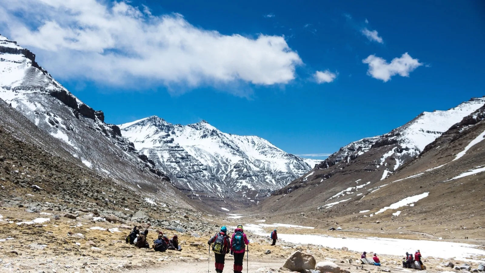
The high-altitude corridor connecting the holy town of Gangotri to the glacial snout at Gaumukh represents one of the most ecologically sensitive and strictly regulated alpine routes in the Garhwal Himalayas. Situated within Gangotri National Park—a protected sanctuary established in 1989 that encompasses 1,553 square kilometers and reaches elevations up to 7,083 meters—the trail traces the upper catchment of the Bhagirathi River. The primary destination of this trek is Gaumukh (~4,023 meters), the physical terminus of the Gangotri Glacier and the principal hydrological source of the Ganges River.
Operational management of Gangotri National Park is governed by a dual-calendar framework that balances ecological preservation with religious pilgrimage. The Uttarakhand Forest Department defines the statutory opening window for the national park as running from April 1 through November 30, 2026. In contrast, access to the town of Gangotri and its associated services follows the ceremonial schedule of the Gangotri Dham temple, which opened on April 19, 2026 (coinciding with Akshaya Tritiya) and closes in early November (~November 10).
The trekking season is sharply divided into two distinct operational windows by the South Asian summer monsoon. The pre-monsoon window spans from May through mid-June, characterized by clearing skies, moderate daytime temperatures, and high demand for permits. By mid-June, monsoon precipitation destabilizes the steep sedimentary slopes of the Bhagirathi valley, causing frequent landslides along the primary vehicular access corridor from Uttarkashi and heightening rockfall risks along the trail. Consequently, park gates effectively close during July and August. The post-monsoon operational window reopens in mid-September and extends through mid-October, providing stable atmospheric conditions, exceptionally clear mountain visibility, and declining ambient temperatures. By late October, sub-zero freezes and early winter snowfall increase high-altitude hazards, leading to the park's formal closure on November 30.
| Seasonal Window | Calendar Period | Atmospheric and Geological Conditions | Operational Status and Field Implications |
| Early Spring Opening | April 1 – April 18, 2026 |
Sub-zero night temperatures, residual snowpacks, low human traffic. |
Park legally open; limited commercial and logistics infrastructure prior to temple opening. |
| Pre-Monsoon Peak | May 1 – Mid-June 2026 |
Clear morning skies, moderate daytime temperatures, maximum visitor traffic. |
Optimal primary window; daily permit allocations exhaust rapidly. |
| Monsoon Interdiction | Mid-June – Late August 2026 |
Heavy rainfall, severe landslide risk along access highways, high trail erosion. |
Route effectively shut; high risk of flash floods and mass wasting events. |
| Post-Monsoon Window | Mid-September – Mid-October 2026 |
Crisp atmospheric clarity, dry trail conditions, rapidly cooling night temperatures. |
Optimal secondary window; highly recommended for clear mountain views. |
| Late Autumn Closure | Late October – November 30, 2026 |
Severe night frosts, high-altitude trail icing, brief daylight hours. |
High risk of early heavy snowfall; park closes November 30. |
Regulatory Framework, Statutory Directives, and Permit Protocols
To safeguard the Gangotri Glacier ecosystem—which experienced a record influx of 29,162 visitors in 2025, generating over ₹80 lakh in entry fees—the Uttarakhand Forest Department enforces a rigid carrying-capacity cap. Entry beyond the Gangotri forest checkpost is strictly limited to 150 permitted individuals per day. Former guidelines referencing a 100-person limit are obsolete; the 150-person daily quota is actively monitored by forest officials.
Following administrative updates implemented on September 10, 2024, three mandatory prerequisites apply to all independent and organized trekkers entering Gangotri National Park for the 2026 season:
- Mandatory Registered Mountain Guide: Trekkers are legally prohibited from traversing the national park without an accredited guide registered with the Uttarkashi district administration or local forest authorities.
- High-Altitude Travel Insurance: Every trekker must possess active travel insurance covering high-altitude trekking, search and rescue operations, and emergency medical evacuation up to 4,500 meters.
- Certified Medical Fitness Clearance: Participants must submit a physical fitness certificate executed by a licensed medical physician. Trekkers aged 60 and older are additionally required to submit a signed old-age self-declaration and medical liability waiver.
Permits are issued through both digital and physical administrative channels. The primary digital portal is the official Single Window System (swstourismuki.com or exploreuttarkashi.com), where applications, government identification (Aadhaar or Passport), medical certificates, and insurance documents are submitted electronically. Offline permits can be obtained at the District Forest Office (DFO) in Uttarkashi or the Gangotri Forest Office located above the bus terminal. In Gangotri town, physical permit processing is restricted to fixed daily windows, typically operating between 08:00–10:00 AM and 05:00–07:00 PM.
| Regulatory Element | Cost for Indian Nationals | Cost for Foreign Nationals | Administrative Guidelines |
| Forest Entrance Permit |
₹150 per person |
₹600 per person |
Valid for 2 days within national park boundaries. |
| Portal / Agency Processing Fee |
₹100 – ₹1,500 file charge |
₹100 – ₹1,500 file charge |
Depends on whether booked directly or via local operators. |
| Registered Guide Fee |
₹2,250 per day |
₹2,250 per day |
Trekker covers guide's high-altitude food and lodging. |
| Refundable Waste Deposit |
Variable cash deposit |
Variable cash deposit |
Assessed based on non-biodegradable item count at gate. |
| Camera / Media Tariff |
Up to ₹500 per unit |
Up to ₹500 per unit |
Enforced for specialized photography equipment. |
Environmental protection protocols are strictly enforced at the main forest checkpost, situated approximately 2 kilometers upstream from Gangotri town. Operating daily from 06:00 AM, forest officers conduct exhaustive inspections of all backpacks. Non-biodegradable products—such as plastic water bottles, energy bar wrappers, and pre-packaged meals—are tallied, logged, and recorded directly on the trekker's physical permit paper. A refundable monetary deposit is collected upfront; it is returned only when the trekker presents the exact quantity of plastic waste upon exiting the park. Additionally, operating recreational drones within Gangotri National Park is strictly prohibited to prevent disturbing local wildlife and maintain security in sensitive border zones.
Glaciological Dynamics, Elevation Profile, and Spatial Hazards
The Gangotri Glacier is one of the largest ice bodies in the Himalayas, containing an estimated ice volume exceeding 27 cubic kilometers and extending over 30 kilometers in length. However, long-term glaciological monitoring reveals significant retreat. Survey data compiled between 1935 and the present day indicate a total retreat exceeding 1,700 meters. Historical retreat rates ranged from 5.9 meters per year between 1965 and 1968, surging to a peak of 26.9 meters per year between 1968 and 1980, before stabilizing at annual retreat rates between 20 and 38 meters in recent decades.
This rapid retreat has severely compromised the structural stability of the Gaumukh ice cave (snout). Thermal undercut, calving ice blocks, and frequent rockfalls make the immediate vicinity of the snout extraordinarily hazardous. As a result, the Uttarakhand Forest Department enforces a mandatory 500-meter exclusion buffer around the active ice portal. Trekkers are strictly forbidden from stepping onto the terminal ice face or approaching within 500 meters of the cavern mouth; all viewing and religious observances must occur from designated moraine ridges situated behind physical hazard markers.
The standard trail from Gangotri to Gaumukh covers a distance of 18 kilometers one-way, resulting in a 36-kilometer round-trip journey. For expeditions extending beyond Gaumukh to the high alpine meadow of Tapovan (~4,463 meters), the total round-trip distance reaches 46 to 50 kilometers.
| Route Segment | Elevation Range | Distance (One-Way) | Terrain Characteristics and Physical Hazards |
| Gangotri to Forest Checkpost |
3,100 m → 3,150 m |
2.0 km |
Paved stone trail, gradual gradient alongside the Bhagirathi River. |
| Checkpost to Chirbasa |
3,150 m → 3,400 m |
7.0 km |
Well-defined dirt path through pine (Pinus wallichiana) stands. |
| Chirbasa to Bhojbasa |
3,400 m → 3,800 m |
5.0 km |
Arid alpine valley, loose scree, active rockfall zones. |
| Bhojbasa to Gaumukh |
3,800 m → 4,023 m |
4.0 km |
Boulder fields, unbridged glacial streams, lateral moraines. |
| Gaumukh to Tapovan Extension |
4,023 m → 4,463 m |
5.0 km |
Near-vertical granite climb, glacier crossing, Akash Ganga stream traverse. |
The journey begins at Gangotri Temple (3,100 meters), climbing a flight of stone steps before leveling into a path along the right bank of the Bhagirathi River. The 7-kilometer trail from the forest checkpost to Chirbasa (3,400 meters) ascends gradually through pine forests. Chirbasa serves as a primary mid-way rest point with basic seasonal dhabas offering tea and simple meals.
Beyond Chirbasa, the forest thins rapidly, transitioning into an arid alpine environment dominated by scattered birch (Bhojpatra) trees. The 5-kilometer section between Chirbasa and Bhojbasa crosses several active rockfall chutes where mountain faces are prone to sudden stone drops triggered by wind or thermal expansion. Trekkers must move steadily across these scree zones without stopping.
From Bhojbasa (3,800 meters) to Gaumukh (4,023 meters), the trail leaves dirt paths behind, navigating over loose terminal moraines, slippery granite boulders, and seasonal meltwater streams. While the gradient remains moderate, navigating loose footing requires careful attention.
For those continuing to Tapovan, the trail crosses the lateral moraine of the Gangotri Glacier and climbs steeply up a nearly vertical 500-meter wall, requiring hand-over-foot scrambling and a tricky crossing of the Akash Ganga stream.
Field Operations, Staging Logistics, and Accommodation Infrastructure
Bhojbasa (~3,800 meters) is the designated overnight staging post along the Gangotri-Gaumukh trail. Strict national park regulations prohibit camping or staying overnight past Bhojbasa toward the glacier to prevent ecosystem disturbance and human waste accumulation in the glacial catchment.
| Accommodation Provider | Lodging Category and Setup | Cost Structure per Person | Booking Procedures and Amenities |
| GMVN Tourist Rest House |
Permanent building dormitories and fixed tent structures. |
₹400 – ₹500 (Dormitory); ₹300 (Tent). |
Advance online booking required via GMVN portal; vegetarian meals charged separately. |
| Lal Baba Ashram |
Shared stone dormitory halls and floor bedding. |
₹300 – ₹500 (Includes simple meals). |
On-site walk-in allocation; basic blankets and communal vegetarian dining provided. |
| Ram Baba Ashram |
Small stone cottage dormitory. |
₹300 – ₹350 (Includes simple meals). |
Limited capacity; basic shelter and hot tea provided on-site. |
| Designated Camping Grounds |
Pitching zones for organized trekking groups and private tents. |
Included in tour packages or covered by camping fees. |
Tents must be pitched exclusively in authorized zones near the riverbank. |
Bhojbasa operates without connection to the national electrical grid. GMVN runs a fossil-fuel generator for roughly 1.5 hours each evening (typically 07:00 PM to 08:30 PM), allowing visitors to charge essential devices for a small fee. Beyond the forest checkpost at Gangotri, cellular phone signals cease entirely. In emergencies, local GMVN management relies on high-frequency wireless radio systems operated by the Indian Army and the Indo-Tibetan Border Police (ITBP) to communicate with district officials in Gangotri and Uttarkashi.
Pony services are permitted between the Gangotri checkpost and Bhojbasa, operating at government-approved return rates between ₹1,800 and ₹2,500. However, ponies are strictly banned from moving past Bhojbasa toward Gaumukh due to the fragile, narrow moraine terrain. Trekkers who require personal backpack offloading can hire local porters at Gangotri for ₹500 to ₹600 per bag per day.
High-Altitude Physiology, Medical Protocols, and Gear Specifications
Ascending rapidly from Gangotri (3,100 meters) to Bhojbasa (3,800 meters) and Gaumukh (4,023 meters) exposes the human body to decreased atmospheric pressure and lower oxygen availability. Unacclimatized trekkers face significant risks of Acute Mountain Sickness (AMS), High Altitude Pulmonary Edema (HAPE), and High Altitude Cerebral Edema (HACE).
Physiological symptoms of high-altitude distress include persistent throbbing headaches, nausea, dizziness, insomnia, fatigue, and loss of coordination. Standard field safety protocols require:
- Staged Altitude Exposure: Spending at least 24 to 48 hours acclimatizing in Gangotri town (3,100 meters) prior to starting the trek.
- Systemic Hydration: Consuming 3 to 4 liters of water daily, supplemented with Oral Rehydration Salts (ORS) to replace electrolytes lost through increased respiration.
- Prophylactic Support: Using Acetazolamide (Diamox) under medical supervision to stimulate breathing and speed natural acclimatization.
- Immediate Descent Protocol: If a trekker develops signs of ataxia, confusion, or severe breathlessness at rest, an immediate descent toward Gangotri (a drop of 700 to 900 meters) is mandatory.
Physical preparation should begin 6 to 8 weeks before departure. Trekkers must be capable of running or power-walking 5 kilometers on flat terrain in under 40 minutes. Workouts should focus on leg strength through weighted squats, lunges, and step-ups, along with practice hikes carrying a loaded 7 to 10 kg daypack.
High-altitude conditions along the Gangotri Glacier fluctuate drastically; sunny mid-day temperatures around 15°C can drop to -5°C or lower within an hour of sunset at Bhojbasa. Trekkers must utilize a technical three-layer clothing system.
| Gear Category | Equipment Item | Technical Specification / Operational Standard |
| Layering System | Thermal Base Layer |
Synthetic quick-dry tops and bottoms (1–2 sets); avoid cotton. |
| Insulating Mid-Layer |
Heavy fleece jacket or grid-fleece pullover. |
|
| Outer Insulation |
Down or synthetic hollow-fill jacket rated to -10°C. |
|
| Shell Protection |
Windproof and waterproof hardshell jacket and pants (or heavy poncho). |
|
| Footwear | Trekking Boots |
High-ankle boots with deep Vibram-style lug soles; fully broken-in. |
| Technical Socks |
3 pairs quick-dry synthetic trek socks; 2 pairs thick merino wool socks for campsite wear. |
|
| Trail Gaiters |
Waterproof nylon gaiters to block scree, mud, and stream splashes. |
|
| Packs & Hardware | Main Rucksack |
50L – 60L internal-frame pack with integrated rain cover. |
| Daypack |
20L – 30L pack for carrying water, rain gear, and personal medical kit. |
|
| Trekking Poles |
Pair of adjustable aluminum or carbon-fiber poles with rubber tips. |
|
| Illumination |
LED headlamp (200+ lumens) with spare lithium batteries. |
|
| Hydration & Storage | Water Vessels |
Two 1-Liter insulated stainless steel or BPA-free wide-mouth bottles. |
| Personal Cutlery |
Reusable steel lunchbox, spoon, and insulated mug for campsite meals. |
|
| Medical Kit | Personal Pharmacy |
Diamox, Dolo 650, Combiflam, Digene, Avomine, ORS packets, knee support sleeves. |
Strategic Recommendations and Operational Synthesis
Successfully navigating the Gangotri to Gaumukh route requires balancing logistical preparation with respect for high-altitude weather and park regulations. The policies introduced in late 2024—mandatory registered guides, proof of insurance, and medical clearances—have established a structured framework that mitigates risks along this remote trail. By maintaining a strict 150-person daily limit, forest authorities protect the valley's delicate ecology while reducing human pressure on fragile trail infrastructure.
The mandatory 500-meter safety buffer around the active glacier snout directly addresses the geological hazards posed by glacier recession. As climate dynamics continue to reshape the ice cave at an average retreat rate of 20 to 38 meters annually, staying behind safety markers is essential to prevent accidents from ice collapses and rockfalls.
Organizers and independent trekkers should secure permits through the official digital portal well before arriving in Uttarkashi. Incorporating a mandatory 24- to 48-hour acclimatization period at Gangotri town, reserving Bhojbasa lodging in advance, and adhering strictly to non-biodegradable waste protocols ensures a safe journey along the source of the Ganges.
This is for informational purposes only. For medical advice or diagnosis, consult a professional.
Keep Reading
View All Articles-
Complete Guide to Muktinath (Muktikshetra): The Ultimate Pilgrimage in Nepal
Muktinath, known traditionally as Muktikshetra (the site for salvation), stands as one of the most spiritually profound, historically rich, and visually breathtaking pilgrimage destinations in the world.
-
Kailash-Manasarovar: The Nepal Route
Axis Mundi: Spine of the Universe, The Ultimate Guide to Kailash Manasarovar Yatra via Nepal: Itinerary, Safety, Sacred Geography, and Preparation
-
Kedarnath Yatra by Helicopter via IRCTC HeliYatra
Shri Kedarnath Dham, located at an altitude of 3,583 meters (11,755 feet) above sea level in the Rudraprayag district of Uttarakhand, stands as one of the most revered Jyotirlingas in the Garhwal Himalayas.